Returning to routine after a month-long expedition can feel like a punishment. And yet, my time in the mountains and my life in the valley don't just complement each other — they need each other.
After many months working as a teacher and a year recovering from a chronic injury to my right foot, I spent August in the Peruvian Andes: first as a mountain guide, then pursuing my own adventures.
I love travelling and giving free rein to my geographer's calling. I'm drawn to sport in intense natural settings: the cold mountain air or the salty ocean breeze make me feel alive. My only purpose is to move through those landscapes and absorb their rhythm.
I've just returned from Peru and Ecuador — two destinations I've visited several times. I've always dreamed of these Americas: exotic for the sheer variety of territories and people, yet somewhere I feel at home. I identify deeply with rural communities, those who feel connected to the land, give everything to it, and actively defend its conservation.
What is the Ausangate trek and why is it worth doing?
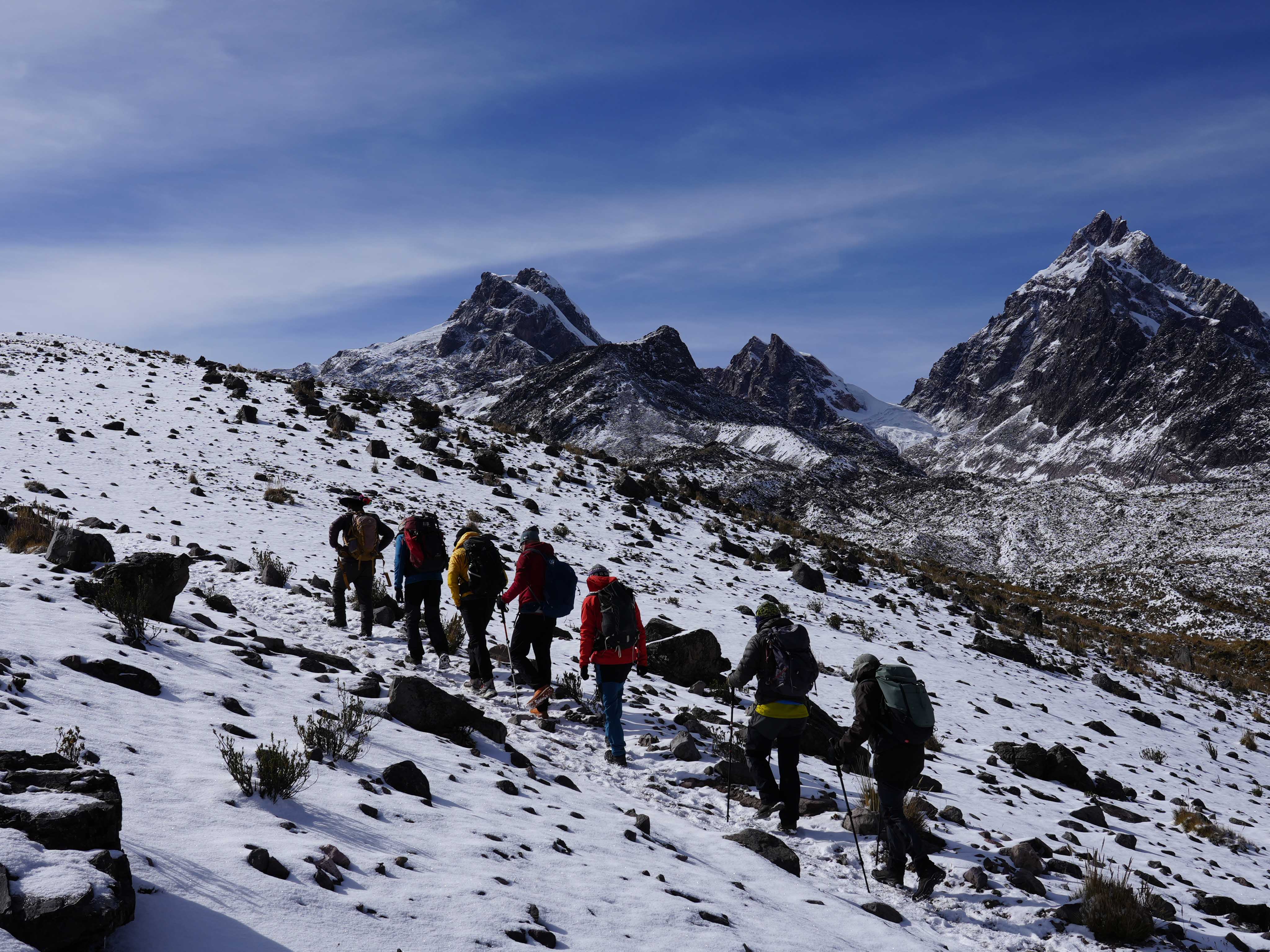
Nevado Ausangate (6,385 m.) is the highest peak in the Vilcanota range in the Cusco region, and one of the great high-mountain destinations in South America. The circuit around it covers 65 kilometres over seven days, and is considered one of the most spectacular treks in the Peruvian Andes.
My first objective on this trip was to guide a group of mountaineers along this route while acclimatising for my own summit attempt.
We began in Cusco, capital of the ancient Inca Empire, at 3,400 metres — the perfect starting point for the gradual acclimatisation that any high-altitude Andean expedition demands.
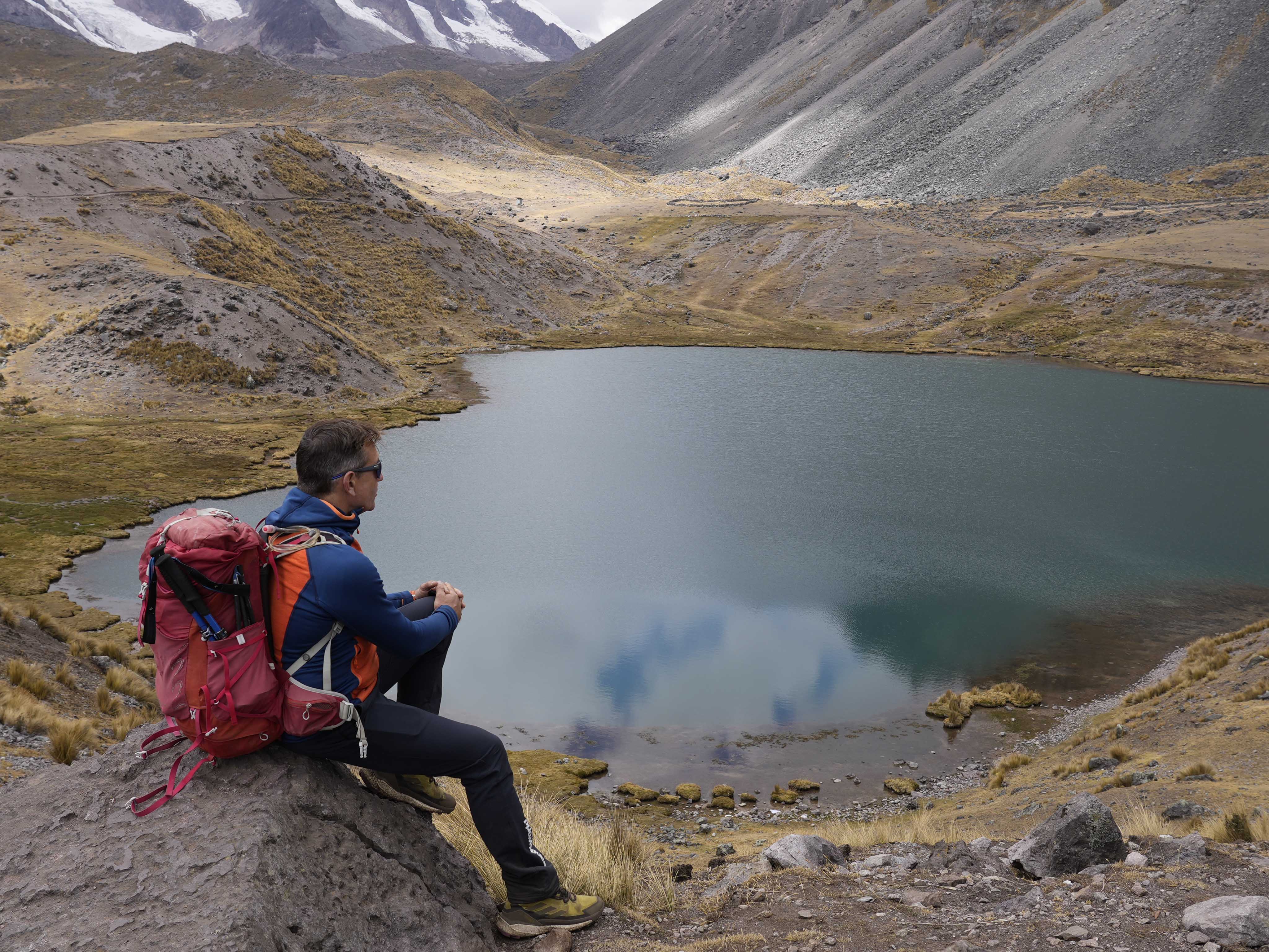
The circuit genuinely surprised me. Despite having completed three other treks in Peru — Salkantay, Huayhuash and Santa Cruz — Ausangate never stopped astonishing me: the variety of landscapes, the exclusivity of places like Laguna Pukacocha or the panorama from base camp are hard to match.
From the very start the landscape is unmistakably high altitude: yellow grasslands, ochre and grey rock, turquoise lakes and white glaciers create a chromatic palette unique to the Peruvian mountains that I don't recall seeing anywhere before.
But it's not only the physical geography that stands out — the human geography does too. In the few small villages scattered along the route, llama and alpaca herders still live a rural life unlike anything in our latitudes. My greatest surprise was a chance encounter with Juana, who was weaving on a portable loom using the same ancestral technique as her ancestors, while her animals grazed nearby. Meeting her felt like stepping back in time.
What clothing and gear do you need for the Ausangate trek?
Weather conditions in the Vilcanota range are highly changeable: nights drop below 0°C while midday temperatures can exceed 20°C. The key is light, breathable layers you can combine as the day changes. During the trek I used the RIMONT t-shirt, STUOR DF shorts and CHAMPEX t-shirt from Trangoworld, which allowed me to adapt comfortably to those extreme atmospheric contrasts.
The final three days took us along the southern face of Ausangate, where glaciers hang from the mountains down into the valleys, feeding countless lakes. The Apus — the name locals give to their sacred mountains — are a source of both reverence and vital natural resources, including the water that irrigates pastures and sustains life in these high valleys.
After many mountain landscapes, kilometres covered and elevation gained, we reached the Rainbow Mountain. Hidden under snow until just a few years ago, climate change has exposed its extraordinary colours, making it one of the most important tourist landmarks in southern Peru. I camped an hour away and we approached at dusk, almost alone, enjoying that extraordinary setting in total peace.
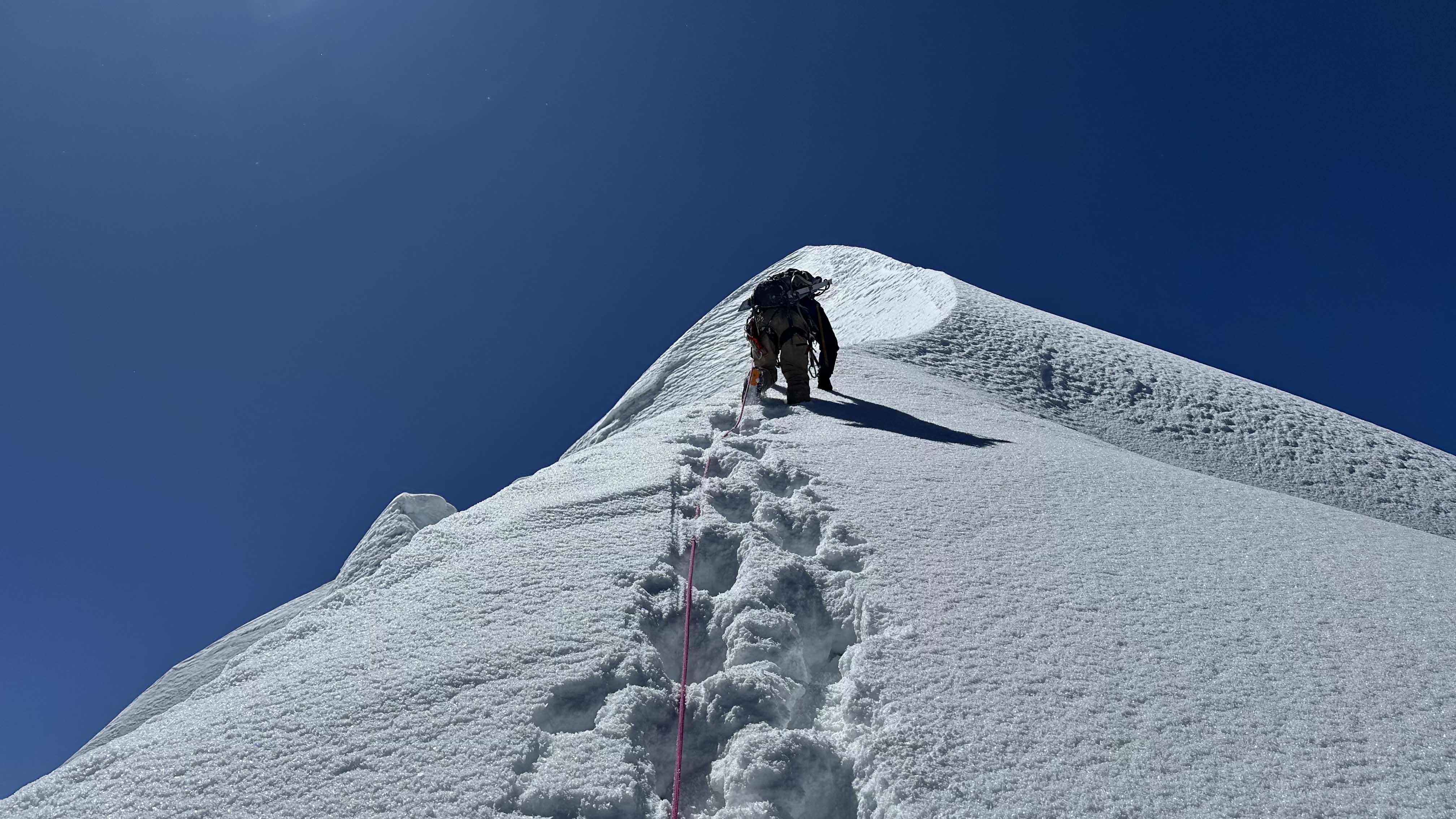
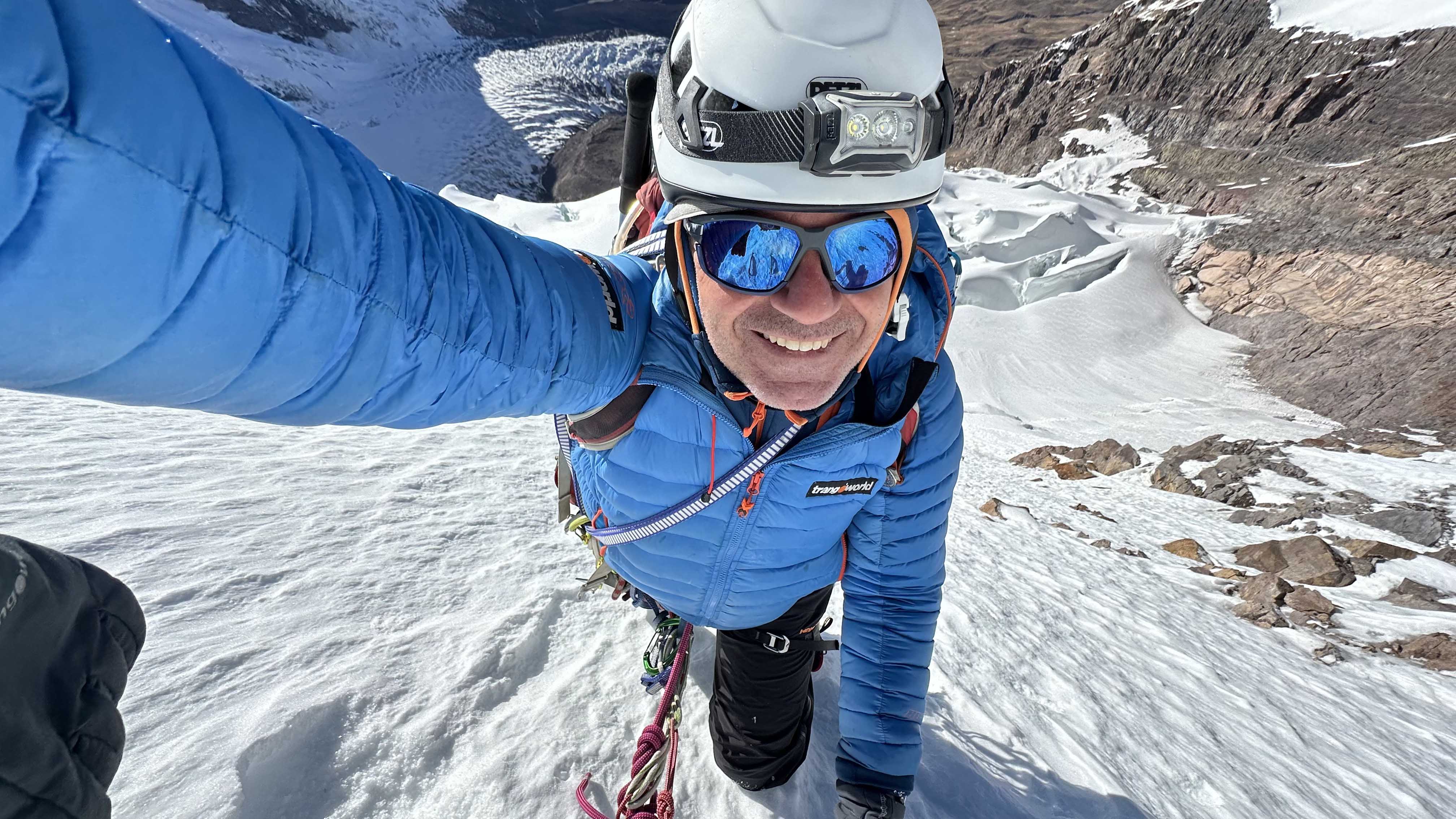
Ascent of Ausangate: 20 hours to reach 6,385 metres
After seeing the group off in Cusco, I returned to Ausangate base camp with two companions: Carlos Pedros, who had joined from Spain, and Luis Crispín, a Peruvian friend with whom I've shared other adventures.
What is the ascent route on Ausangate like?
When we studied the possible route, we faced an unpleasant surprise: a section of ice normally used for the ascent had disappeared, leaving only loose rock — a consequence of climate change. Through binoculars, however, we spotted a 70-degree ice slope to the right, approximately 300 metres long.
Andean mountaineering guides rate the traditional route at D+. Our variant via the ice slope could reach MD. It was time to reflect, discuss and decide. We chose to try it, trusting that once past that technical section we could reach the final ridges leading to the summit.
The real difficulty, however, was not the ice slope but the upper section: freshly accumulated snow with the typical rounded grains that offer very little cohesion, severely slowing progress and putting the summit in doubt.
The weather was perfect — not a cloud in sight — so we took turns breaking trail, often sinking to our waists. Exhausted but determined, we traded hours for metres of altitude. After twelve hours from base camp we finally saw the final ridge: heavily windswept, airy, blanketed in deep unstable snow. Determination and conditions were on our side. Slowly, we made it to the top. We embraced, took in the panoramic views for a few minutes, and began the descent.
What technical gear did I use on the Ausangate ascent?
On the ascent I had the chance to test Trangoworld's new ALADREN high-mountain trousers: incredibly light and breathable, yet capable of guaranteed waterproofing in snow as deep as what we encountered. That proved decisive not just for comfort, but for safety above 6,000 metres. For my second layer I used the ETIVE fleece jacket combined with the TRX2 jacket — a combination that allowed me to work comfortably throughout the ascent and became my most-used layering system of the entire trip.
A few days on, I'm convinced this was one of the hardest ascents I can remember: twenty hours of total activity from Camp 1. Despite not being an exceptionally high mountain, the conditions demanded everything we had. We arrived at the tent completely spent — far more tired than happy. But now, back home, I'm deeply satisfied with what we achieved, with the knowledge that my foot is recovering, and with the confirmation that I'm still capable of great adventures.
As those who follow me know, I've been lucky enough to summit several eight-thousanders, including Everest. But we must remember: it's not altitude alone that makes mountains great.